Land Construction Company
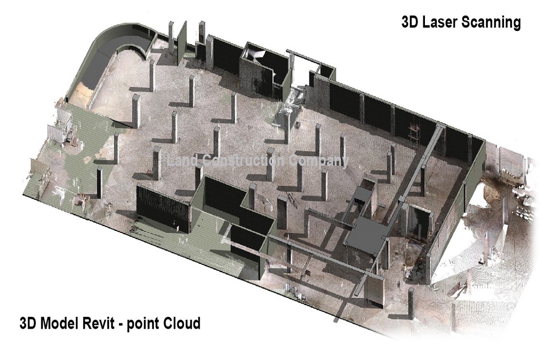
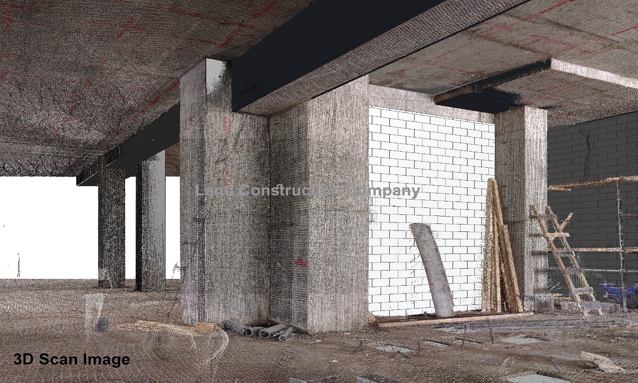
3D Laser scanning is a very powerful 3D imaging tool. Laser scanning has the advantage of full 3d capture of the desired area in X, Y, Z coordinates without physical contact. The scanner emits a laser beam and produces a 360-degree scan image with literally millions of 3d points forming a point ‘cloud’.
The speed of acquisition and the sheer density of points enable very detailed 3d mapping of complex objects and landscapes. Once these point clouds are captured, 3D BIM modeling and meshing can be performed or extracted from the cloud.
3D Laser Scanning and BIM Modelling
Point Cloud Modelling and 3D Revit Model
Trimble TX8 3D Laser Scanner
Our Trimble TX8 3D Laser Scanner sets new standards for performance and ease of use in the high-speed collection of 3D data. Using a state-of-the-art blend of speed, long range, and precision, the Trimble TX8 delivers high quality results in the civil survey, chemical plant and industrial measurement, civil and mechanical engineering, and construction. The Trimble TX8 can measure One Million Points per second while capturing precise data over its full measurement range. Making high speed measurements without compromising range or precision, the Trimble TX8 3D Laser Scanning delivers the high-density 3D point cloud design and analysis professionals need. The Trimble TX8 provides a 360° x 317° field of view and captures full high density scans in only three minutes. The Trimble TX8 maintains its high precision over the entire range of 340 meters with no need to reduce speed.
FARO 3D Laser Scanner
Our FARO 3D Laser Scanner (350s), with a possible accuracy of 10m: 2mm / 25m: 3.5mm. It emits up to 976,000 points per second to capture detailed measurements of complex objects and spaces. This ultra-portable, lightweight device can be set up on-site and ready to go within minutes, mounted on a floor tripod, or even suspended in an inverted position from above. Although it runs off 19V external power, this versatile unit also has a battery life of 4.5 hours so can operate under virtually any conditions.
How We Use It
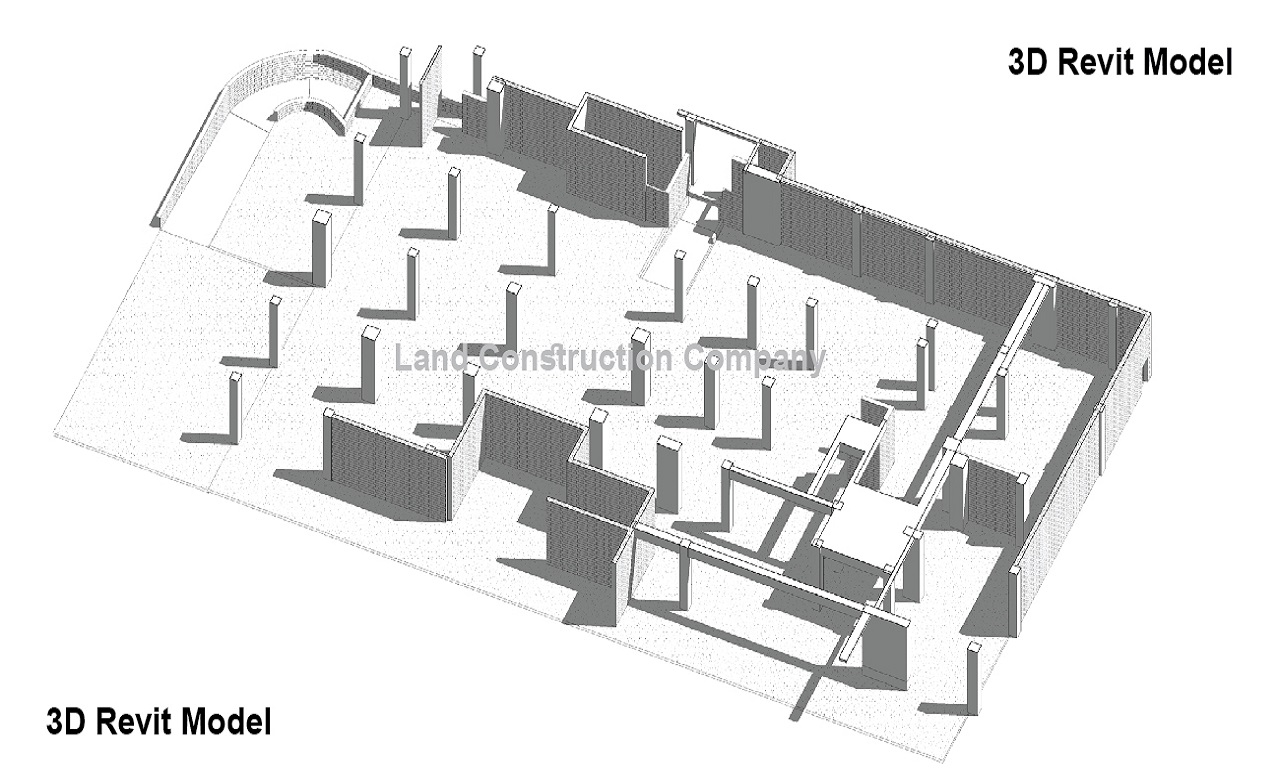
The Revit modeling (BIM Modeling) experts at 3D Laser Scans & Drawable use the scanner data to provide complete verification of the work you have done on your project, whatever your trade. At any stage of your build or installation, our highly trained operator can attend to your site and perform the scan with minimal disruption to any work in progress. We then interface the captured scan data with the 3D model, for quick and accurate confirmation that your model fulfills the tolerance required in your tender documentation.
3D Laser Scanning and Revit Modeling
Blueprints For Boats, Ships and Vessels
When a boat is in a dry dock for maintenance, it is an opportune time to take a 3D laser scan of the hull. Any sized boat, ship, or vessel can be scanned. For smaller boats (depending on location) this can be done in a day. The scan can be turned into 2D drawings for use by a naval architect, or into 3D solid models for various types of analysis.
Measure Stockpile Volumes
Measuring stockpiles volumes is easily done using long-range 3d laser scanning. The scans can also be taken from the air using a drone. The scans are used to create a digital model of the pile from which the volume can be calculated. Aerial scanning has the advantage of capturing the top of the pile which is sometimes not visible from the ground.
ABOUT THE LAND CONSTRUCTION COMPANY
Land Construction Company | KSA Land Surveyors was founded on the principle of giving our clients a top-quality product. Our full commitment is to excellence within our profession. We assure timely delivery, very competitive prices, and complete client satisfaction.
LCC is a company that is focused on delivering Civil Construction, Earthwork, Road Construction, Land Survey, Topographic, Quantity Survey, ArcGIS Services, GIS Remote Sensing, GIS Mapping, and Earthwork Quantity, cut and fill quantity, 3D Revit Model, and 3D Laser Scanning Services in the construction environment. LCC is Kingdom Saudi Arabia based company.
3D Laser Scanning & Point Cloud Modelling
Company Profile
3D Laser Scanning
Building Renovations and Extensions
Incomplete or inaccurate as-built drawings for an existing building can often hamper plans and designs for future extensions and renovations. Laser scanning captures a site’s detail in its current form so the data can be converted into intelligent CAD models and used to develop extremely accurate existing condition drawings while providing quality assurance across the project lifecycle.
Plant and Processing Sites
Use 3D laser scanning to find the exact location and dimensions of plant and pipework in sites where access is otherwise not possible. A 3D dimensional model of the area of interest can then be used for engineering design, allowing new elements to be manufactured without stopping production to take measurements.
3D Laser Scanning and BIM Modeling
Ideal Types of 3D Scanning
⇒ Architectural Structures, Industrial Plants, Oil and Gas Plants, Power Plants, Tanks & Vessels, Factories & Warehouses, Historical Buildings, Ships & Boats 3D Laser Scanning.
⇒ Building Information Management (BIM) – detailed as-builts of existing structures.
⇒ Capturing in fine detail ornate buildings and monuments.
⇒ Cavities and underground tunneling data acquisition.
⇒ Industrial applications include the location of complex pipework.
⇒ Mining and bulk earthworks terrain modeling and very accurate volumes.
⇒ Creating 3D images of existing plants, offices, or other assets.
⇒ Long distance monitoring/ change detection & Slope stability studies.
⇒ Construction Sites verifying the installation against the 3D Revit Model.
Benefits of 3D Laser Scanning
⇒ Fast, efficient, and accurate recording of existing spaces and services.
⇒ Immediate processing and task distribution with wireless scan data.
⇒ Capture real-world information to verify the model and represent your work.
⇒ Measure complex structures with ease in extreme lighting conditions.
⇒ Deliver contractual obligations with complete model accuracy.
⇒ Interface with industry-standard software (Revit, AutoCAD, Bentley products, etc).
As a civil, earthwork, infrastructure, land survey, topographic survey, gis mapping, Geodetic Control Survey, Control Point, Benchmark Elevation, 3D Revit Model, and 3d laser scanning, Land Construction Co., adopts a disciplined and consistent approach each and every time we take on projects… regardless of size or scale.
Our conservative approach ensures all projects tendered for are competitively priced with adequate resources assigned to ensure high-quality delivery in a timely manner.
Embedded in our culture of hard work, honesty, and getting the well done job, our history tells not only much about our past but also it does our present.е Our record of succeeding, surviving, and striving to be the best is central to our reputation today.
3D Laser Scanning for Heritage
3D Point Cloud Modelling and Revit Model
Chemical and Industrial Plant 3D Laser Scanning
3D Laser Scanning, BIM Modeling and AutoCAD Drafting
We can arrange to deliver our high-quality, accurate 3D modeling from our point clouds. Our solutions are tailored to your project needs and can include 3D CAD and Revit modeling, BIM modeling for buildings, high accuracy surface modeling, and as-constructed 3D deformation modeling records.
Heritage and Historical Buildings 3D Laser Scanning
Heritage buildings often have complex surfaces or inaccessible areas that make traditional surveying a challenge. Laser scanning is a non-intrusive and highly accurate means of capturing and cataloging details of fragile, historical objects and structures. Use 3D modeling to quickly and easily determine structural damage and initiate necessary repairs for heritage and historical buildings preservation.
