Geodetic Control Survey Traverse Survey
Land Construction Company
A Geodetic Control Survey network is a group of interconnected geodetic points and serves as the basis for carrying out benchmark (Coordinates and Elevation) measurements in the field of engineering geodesy. Geodetic networks represent the materialization of the coordinate system (UTM, WGS84 etc.) on the site and allow the measurements to be made with the required precision throughout the construction site and at any stage of the construction of the building.
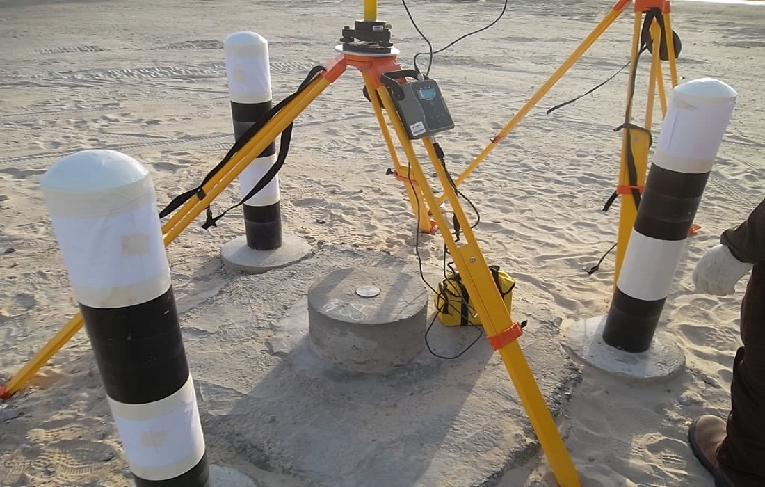
Geodetic Control Survey
Measuring Angles, Distances and Height Differences
With the help of data on the points of the national geodetic control survey network, precise electronic instruments for measuring angles, distances, and height differences, and with the instruments for GNSS measurements, the coordinates of any point in the space can be determined with the accuracy allowed by the selected measurement method.
Depending on the purpose and depending on the specific requirements of individual projects, infrastructure in the space, or for the monitoring of deformations on existing facilities or infrastructures in practice a local geodetic control survey network needs to be established for each construction site.
Traversing and Leveling Survey
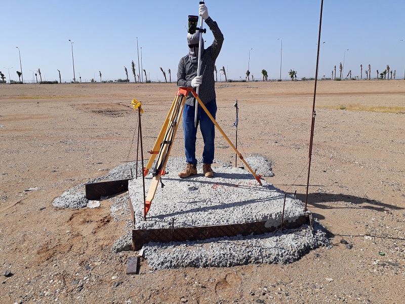
Traverse is that type of survey in which a number of connected survey lines form the framework and the directions and lengths of the survey lines are measured with the help of an angle measuring instrument and tape or chain respectively. There are two types of traverse surveying i.e. Closed Traverse and Open Traverse.
Leveling is the process of determining the height of one level relative to another. It is used in surveying to establish the elevation of a point relative to a datum or to establish a point at a given elevation relative to a datum. The basic concept of leveling involves the measurement of vertical distance relative to a horizontal line of sight.
Geodetic Control Survey
LCC Establishes the Following Geodetic Networks
⇒ Horizontal (positional or benchmark coordinates) geodetic networks.
⇒ Altitude (vertical leveling or benchmark elevation) geodetic networks.
⇒ Three-dimensional (combined or coordinates and elevation) geodetic network.
The Establishment of a Geodetic Control Survey Network is Required
⇒ For detailed measurement of the terrain for the needs of the creation of the geodetic plan.
⇒ To carry out the staking-out of buildings and infrastructure.
⇒ When the data of the existing geodetic points are missing or not updated.
⇒ When the accuracy of the data of the existing geodetic points is inadequate.
⇒ When the geometry of the existing geodetic network survey does not provide the prescribed accuracy of measurements.
⇒ To carry out control measurements at and after the construction of the facility or infrastructure.
ABOUT THE LAND CONSTRUCTION COMPANY
Land Construction Company | KSA Land Surveyors was founded on the principle of giving our clients a top-quality product. Our full commitment is to excellence within our profession. We assure timely delivery, very competitive prices, and complete client satisfaction.
LCC is a company that is focused on delivering Civil Construction, Earthwork, Road Construction, Land Survey, Topographic, Quantity Survey, ArcGIS Services, GIS Remote Sensing, GIS Mapping, and Geodetic Control Survey and Benchmark Elevation Services. in the construction environment. LCC is Kingdom Saudi Arabia based company.
Company Profile
Geodetic Control Survey Services
Geodetic Control Survey
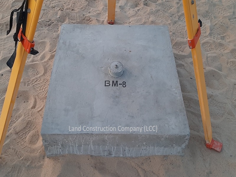
Benchmark Elevation and Coordinates
Geodetic Control Survey networks are the fundamental foundation to support any project from building construction, deformation monitoring, to the national survey network for legal boundaries, geographical information, and mapping.
GPS/GNSS
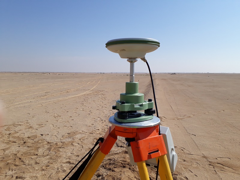
Land Construction Company field survey crews are equipped with Trimble GNSS receivers, real-time kinematic radios, fixed height tripods and rods, and the experience in properly performing any GNSS Survey.
Static Networks
Static GNSS surveys allow for the establishment of high-order controls. LCC has the experience and expertise in establishing primary controls to the highest standards.
Geodetic Control Survey
Geodetic Control Survey Networks Need to be Established
⇒ That geodetic measurements during the construction of the facility will be carried out with the prescribed precision throughout the construction site and at any stage of the construction (a uniform geodetic datum).
⇒ To accurately determine the position of objects in 3D space.
⇒ To produce topographic plans.
⇒ For cadastral measurement, with which we determine the state of plots and objects.
Horizontal and Vertical Control is the Foundation of Every Survey Project
Geodetic Control Surveys encompass the positioning of survey ground points by using GPS or GNSS as per the specifications for intended uses. The extension of GPS/GNSS geodetic control survey networks to remote areas, the establishment of benchmark survey control networks for offshore and underground surveys among others.
Understanding project datums, known controls, accuracy requirements, and acceptable methods to achieve the clients’ expectations are all critical in planning, establishing, and producing control. LCC understands the importance of solid and repeatable control that meets project requirements.
As a civil, earthwork, infrastructure, land survey, topographic survey, gis mapping, Geodetic Control Survey, Control Point, Benchmark Elevation, and 3d laser scanning, Land Construction Co., adopts a disciplined and consistent approach each and every time we take on projects… regardless of size or scale.
Our conservative approach ensures all projects tendered for are competitively priced with adequate resources assigned to ensure high-quality delivery in a timely manner.
Embedded in our culture of hard work, honesty, and getting the well done job, our history tells not only much about our past but also it does our present.е Our record of succeeding, surviving, and striving to be the best is central to our reputation today.
Geodetic Control Point
Datums and Benchmarks
Real-Time Networks
LCC understands when real-time networks (RTN) are practical and appropriate to meet project requirements. We subscribe to several Real-Time networks within the Kingdom of Saudi Arabia.
UTM or WGS 84 Datums/ Benchmarks
Land Construction Company brings the experience and expertise in determining the correct datums and establishing proper benchmark controls.
We are a Survey and Mapping Company and we provide our services to, Jubail, Dammam, Khobar, Riyadh, Makkah, Madinah, Jeddah, Red Sea Project, Neom, Qiddiya, and other Kingdom Saudi Arabia cities.
