Aerial Survey and Drone Mapping
Land Construction Company
Land Construction Company offers professional Drone Survey, Aerial Survey and Mapping all over the Kingdom of Saudi Arabia. Specializing in DTM editing, topographic mapping, point cloud classification, orthophoto production, and data processing.
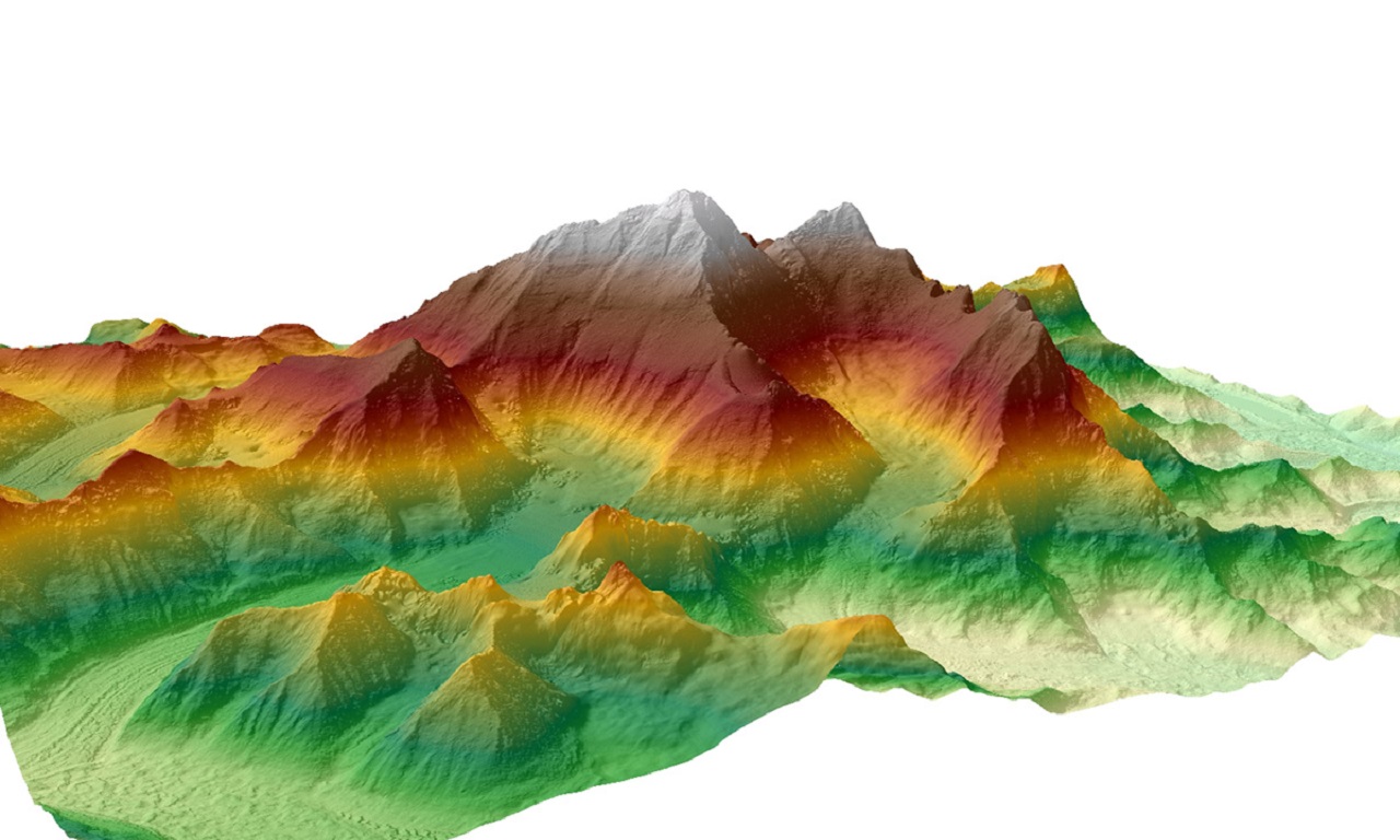
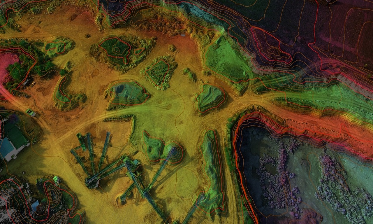
Drone Photogrammetry Definition: Drone photogrammetry consists of taking aerial photographs to give a representative picture of a site or an object. The product can take the form of an orthophoto map, 3D model, or topographical map. Drone Survey are specially adapted to terrains that are difficult or hard to reach by humans.
Aerial Survey and Drone Mapping
Fast & Reliable Drone Surveys
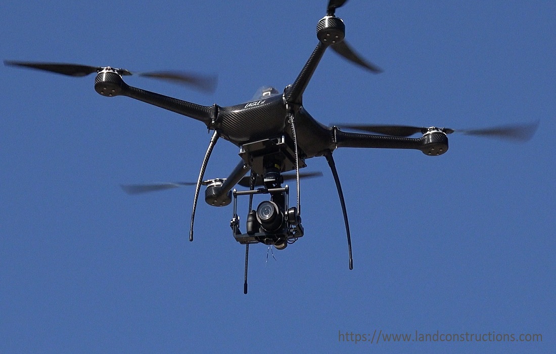
Aerial survey and mapping is a geomatics method of collecting, analyzing, and interpreting data by using UAVs, drones, and other aerial methods and aerial equipment. UAV’s are perfect for aerial mapping with drones survey. The aerial survey procedure integrates an aerial surveying drone, aerial software, and other aerial equipment to produce a chart or map made by analyzing the photogrammetric data of a region.
The ability to make accurate and repeatable flights over difficult terrains makes UAVs ideal for ground mapping. An aerial land survey is a perfect tool for conducting an aerial site survey, aerial lidar survey, aerial photogrammetry survey, aerial photographic survey, aerial topographic survey, or an aerial detection survey.
Aerial survey and mapping using RPAS (drone, UAV, or UAS) is a cost-effective, accurate, and efficient way of generating mapping products. LCC has been supplying high-resolution, accurate aerial services to professionals such as land surveyors, engineers, contractors, quantity surveyors, and developers.
Aerial Survey and Drone Mapping
Lidar Survey Solutions
LCC utilizes leading LiDAR technology to be able to offer tailor-made solutions to your specific LiDAR survey project. We have a multi-year experience in the capture, processing, and delivery of high-quality and high-accuracy LiDAR data. We cover large area LiDAR surveys using our fixed-wing aircraft, through to low-level high-density aerial survey and mapping using LiDAR drones. Typical uses of LiDAR survey data include the following.
⇒ Earth Surface Terrain and 3D modeling.
⇒ Volume surveys & Stockpile Survey.
⇒ Planning and design purposes.
⇒ Powerline and pipeline corridor surveys.
⇒ Floodplain and drainage studies.
⇒ Municipal valuations and urban planning.
⇒ Contours and GIS base layer development.
ABOUT THE LAND CONSTRUCTION COMPANY
Land Construction Company | KSA Land Surveyors was founded on the principle of giving our clients a top-quality product. Our full commitment is to excellence within our profession. We assure timely delivery, very competitive prices, and complete client satisfaction.
LCC is a company that is focused on delivering Civil Construction, Earthwork, Road Construction, Land Survey, Topographic, Quantity Survey, ArcGIS Services, GIS Remote Sensing, GIS Mapping, and Geodetic Control Survey and Aerial Survey and Mapping Services. in the construction environment. LCC is Kingdom Saudi Arabia based company.
Company Profile
Aerial Imagery and Mapping
Aerial Survey and Drone Mapping
Key Benefits
⇒ Contour and Digital Shape and Terrain models (DXF).
⇒ Geo-referenced Point Cloud (LAS, XYZ) & Multiple point data collection.
⇒ Ability to cover large areas quickly and accurately.
⇒ Safer to navigate challenging terrain or inaccessible areas.
⇒ More cost-effective than pilot aircraft or traditional aerial survey and mapping.
⇒ High-resolution imagery and precise modeling.
Aerial Survey and Drone Mapping
Drone Mapping Useful Benefits
⇒ Mapping expansive areas, challenging terrain, and difficult-to-reach environments.
⇒ Elevation modeling, identifying low points for flood risk or watershed analysis.
⇒ Bathymetric surveying, to measure the depth of water bodies and map underwater features.
⇒ Measuring volumes, stockpiles, dredging, and landfills.
⇒ Environmental monitoring, to identify vulnerable areas by showing patterns of erosion, shifts, and other changes.
⇒ Topographic plans and terrain mapping (Aerial Survey and Mapping), for utilities or construction planning, identifying boundaries.
⇒ Exploration mapping, to discover the location of minerals.
⇒ Produce survey-grade maps (2D/Orthomosaic) and accurate 3D models.
⇒ Progress reporting, to understand and measure the performance of projects.
⇒ Color Digital Elevations Maps & Multiple point data collection.
As a civil, earthwork, infrastructure, land survey, topographic survey, Aerial Survey and Mapping, gis mapping, Geodetic Control Survey, Control Point, Benchmark Elevation, and 3d laser scanning, Land Construction Co., adopt a disciplined and consistent approach each and every time we take on projects… regardless of size or scale.
Our conservative approach ensures all projects tendered for are competitively priced with adequate resources assigned to ensure high-quality delivery in a timely manner.
Our vision is to be the company that others use as their benchmark. We will distinguish ourselves through our ability to consistently deliver on our commitments. Our standards will far exceed the expectations of our clients, but we will always strive for improvement. Our vision statement is to achieve a seamless system, from our first introduction to the final walkthrough. To achieve this, each member of our team must believe in and envelope our company’s culture
Aerial Survey and Drone Mapping
Orthophoto Map, 3D Model and Topographical Map
Drone Survey and Drone Mapping
Stockpile Volume Calculation by Drone Survey
Aerial detection surveys or aerial sketch mapping is a remote sensing technology method that is efficient and economical in stockpiling and reporting data from aerial survey maps for agricultural surveying needs. UAV’s affordability combined with high-resolution cameras and drone survey software enables us to produce detailed mapping with multiple-point data.
Land Construction company provides aerial survey mapping and drone survey services for a wide range of the industry including industrial services, construction, landscaping, surveying, agriculture, and real estate offer the following benefits.
