Cadastral Survey Subdivision Survey
Land Construction Company
At Land Construction Company, we provide a wide range of cadastral survey services for land development projects outlined below. We have extensive experience specializing in town planning, land surveying, urban design, and project management.
Cadastral land surveying is a branch of land surveying that focuses on establishing your property boundaries. When Land Construction Co., conducts cadastral surveying on your land, we determine the actual Boundaries and place Boundary marks on the corners of your land.
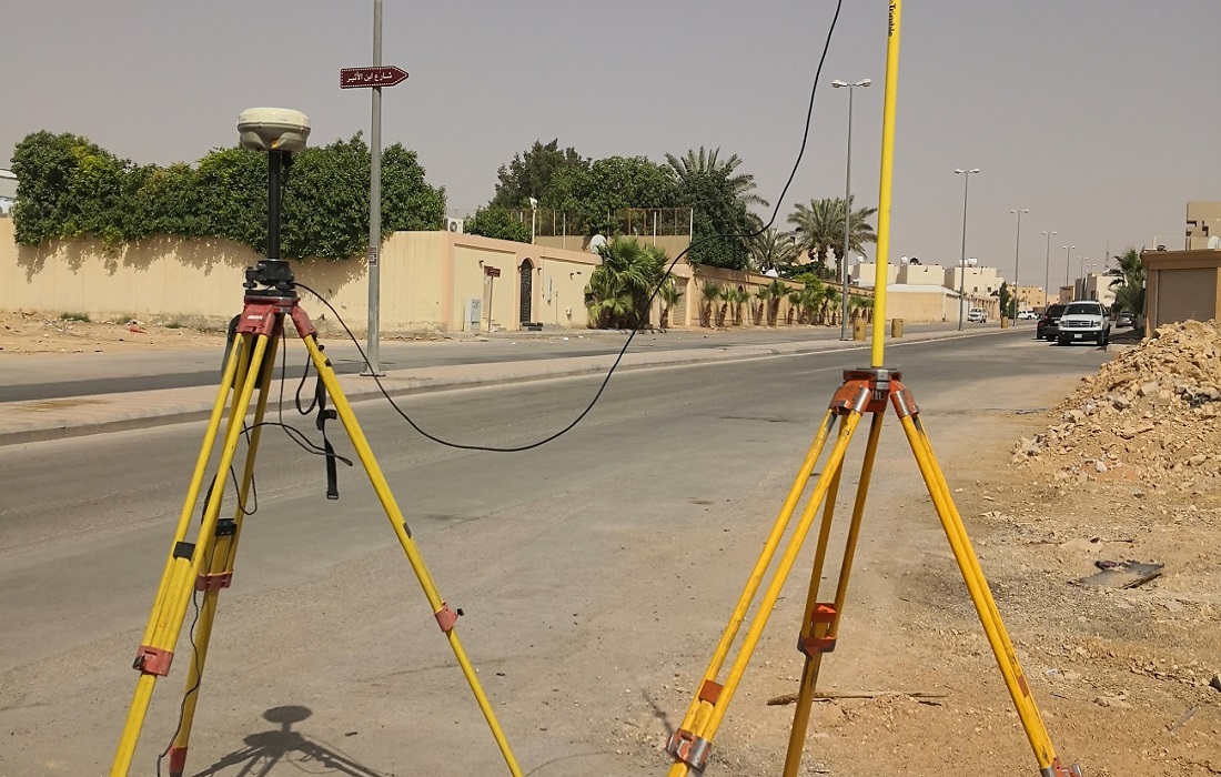
Cadastral Survey
Cadastral Survey for Commercial Property
Cadastral Survey is a type of Land Surveying that deals with the establishment of real property boundaries. Our range of Cadastral Survey services includes surveys to create new property boundaries, subdivision surveys, or surveys for due diligence and design to precisely identify boundaries and the location of any improvements thereon these are known as Identification surveys or Title Re-establishment surveys.
The cadastral survey provides a sharp focus on the laws of land ownership and the definition of property boundaries. It involves interpreting and advising on boundary locations, on the status of land ownership, and on the rights, restrictions, and interests in property, as well as the recording of such information for use on plans, maps, etc. It also involves the physical delineation of property boundaries and determination of dimensions, areas, and certain rights associated with properties, whether they are on land, water, or defined by natural or artificial features.
Cadastral Survey
Subdivision Surveying and Boundary Re-Alignment
Subdivision Surveying
The subdivision surveying is to divide one lot registered in the cadastral register into two lots or more and register. This is mainly used to sell parts of the land or transfer its ownership or get construction approval for parts of the land.
Boundary Re-alignment
Boundary re-alignments provide for the adjustment of boundaries between existing registered properties. The adjustment must be of a minor nature or be a result of exchanging land with a neighbor. Key considerations include:
• The location, size, and topography of the development.
• Whether it will necessitate a reallocation of the unit entitlement.
A boundary re-alignment requires the lodgment of a Reconfiguration of a Lot (ROL) application with your area’s relevant Local Authority or Council.
ABOUT THE LAND CONSTRUCTION COMPANY
Land Construction Company | KSA Land Surveyors was founded on the principle of giving our clients a top-quality product. Our full commitment is to excellence within our profession. We assure timely delivery, very competitive prices, and complete client satisfaction.
LCC is a company that is focused on delivering Civil Construction, Earthwork, Road Construction, Land Survey, Topographic, Quantity Survey, ArcGIS Services, GIS Remote Sensing, GIS Mapping, and Cadastral Survey Services. in the construction environment. LCC is Kingdom Saudi Arabia based company.
Company Profile
Cadastral Survey Services
Cadastral Survey
Our Typical Process
Our Typical Process
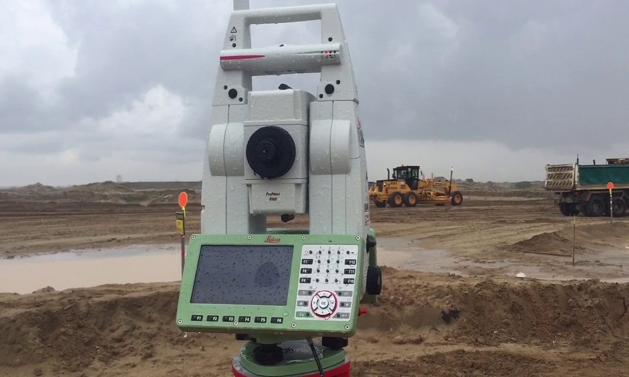
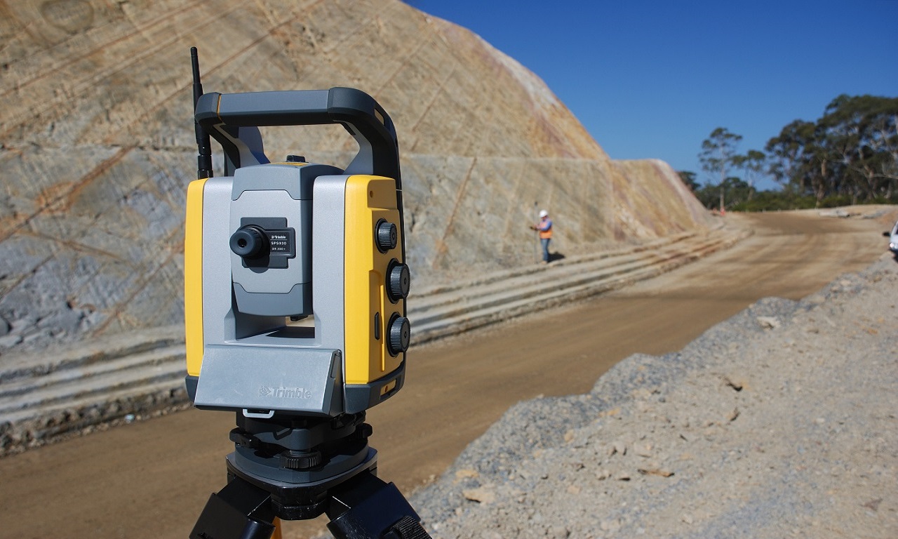
Land Construction Company utilizes the latest surveying technology to capture our data then produce our cadastral survey plans. Using the latest CAD software programs everything is captured and processed accurately to start producing our cadastral survey plans. The equipment we use is state of the art, ranging from traditional total stations to 3D laser scanning or RPA (drone). We only use the latest software tools including AutoCAD, Civil 3D, ArcGIS, Microstation & AutoDesk Revit.
Once our plans are drafted they go through an intensive QA process via an independent audit to ensure that what we have captured is delivered to the highest levels of accuracy possible.
Cadastral Survey
Urban Planning Line Relocation Surveying
Urban Planning Line Relocation Surveying
The urban planning line relocation surveying is to relocate the urban and county management planning line, such as the urban planning line, onto the surface of the land. This is mainly used to check the urban planning line or setback road line when approving the construction.
Re-Establishment Boundary Surveys
Commonly referred to as boundary surveys, this type of survey is used to determine the precise location of the boundaries of an existing title. This can serve a number of purposes but is primarily used to ensure any new construction is confined to the land actually within its own title as fencing positions do not always indicate the true position of a title boundary.
Cadastral Triangle Supplement Point Surveying
The cadastral triangle supplement point surveying is to seek the location of the cadastral triangle supplement point, which will be the basis of cadastral supplementary control point surveying and cadastral detail surveying.
As a civil, earthwork, infrastructure, land survey, topographic survey, gis mapping, cadastral survey, and 3d laser scanning, Land Construction Co., adopts a disciplined and consistent approach each and every time we take on projects… regardless of size or scale.
Our conservative approach ensures all projects tendered for are competitively priced with adequate resources assigned to ensure high-quality delivery in a timely manner.
Embedded in our culture of hard work, honesty, and getting the well done job, our history tells not only much about our past but also it does our present.е Our record of succeeding, surviving, and striving to be the best is central to our reputation today.
Cadastral Survey
In Summary
In Summary (Cadastral Survey)
⇒ Initial consultation to ensure we can meet your needs.
⇒ Agree on a scope of work.
⇒ A site visit is organized with one of our qualified technicians with the necessary data collection equipment.
⇒ All plans or drawings are then independently reviewed via our QA process.
⇒ All deliverables are then created for viewing in PDF, AutoCAD, or Revit.
⇒ We also have the ability to create a 3D scan or virtual tour of your property to create a fully interactive view of a site.
⇒ All data is then processed via our team located in our office.
