Land Construction Company
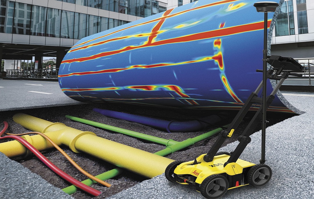
Whether you are looking to locate existing underground utilities detection, pipes, and cables, or want to plan the safe placement of new infrastructure, LCC Company has the underground mapping solution. Depending on your project, site, or what you’re trying to locate, we offer both pipe & cable locating, Concrete Slab Scanning, Cavity Grouting, and (Ground Penetrating Radar) GPR Survey services.
Using precision pipe and cable locators, in hand with GPR (Ground Penetrating Radar) technology, our team can induce, detect and trace underground utilities, underground cavity detection, pipes, and cables prior to any subsurface work being carried out. All work is undertaken in accordance with international and Kingdom Saudi Arabia standards, Standard Code ASTM D-6432.
Underground Mapping & Concrete Structure & Slab Scanning
Underground Utility Survey and Concrete Scanning
When undertaking the design, planning, and delivery of all forms of construction work, the detection of all the services mentioned above is essential. All surveys are carried out using Electromagnetic Detection Methods and Ground Penetrating Radar (GPR) using the latest technologies. All of our surveys are presented using Auto CAD (PDF if required) and delivered to a market-leading standard. All drawings are produced by the surveyor and delivered with accuracy and proficiency. Keeping all aspects of surveying in the house we feel we can offer the complete package that dovetails seamlessly.
All of our clients will receive outstanding service from highly experienced and health and safety-conscious surveyors. We endeavor to deliver excellent, high-quality, professional, and cost-effective surveys from start to finish, tailored to each individual client’s requirements. Here at Land Construction Company, we take every opportunity to enhance the Underground Mapping and ground Penetrating Radar Survey service that we provide to meet the demands and needs of every client.
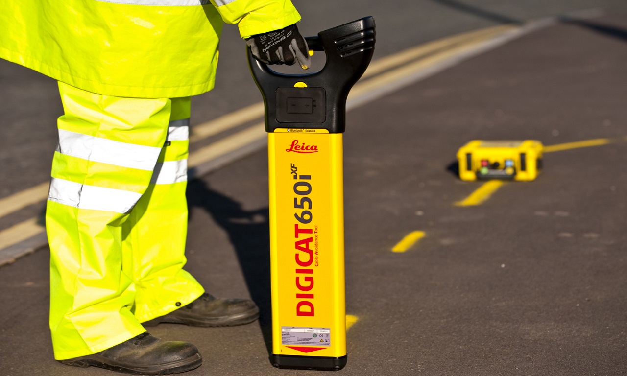
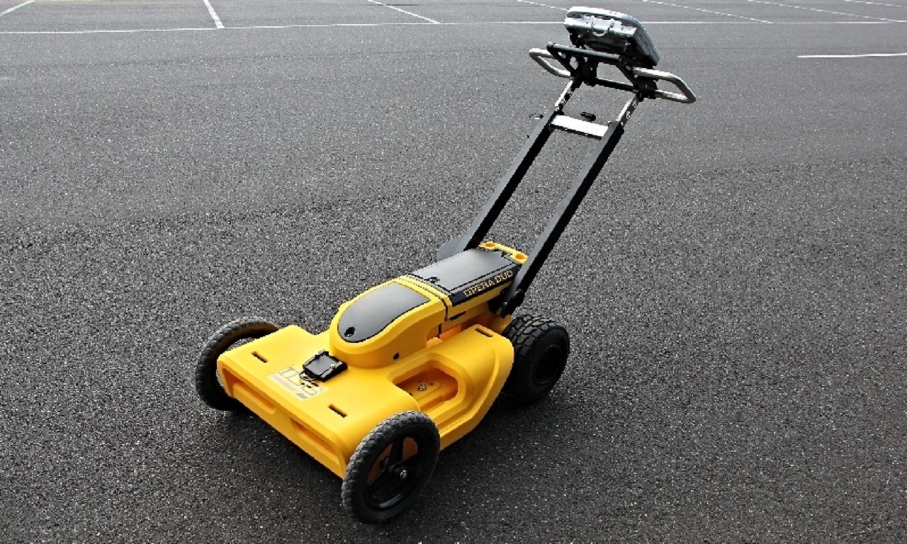
During excavations and drilling, a lot of undocumented services such as pipes and cables get damaged and such damages are costly and detrimental to the success of a project. For the success of such projects, the accurate positioning and location of such underground services are paramount. Underground Utilities and Cavity Detection services are detected and positioned using the latest technology of Ground Penetrating Radar (OKM GEPARD GPR 3D Underground Scanner), ( Proceq GS8000 GPR), (GSSI Utility Scan DF), (GSSI Concrete Structure Scan Mini XT) and Cable Detector (RD8000PXL & RD8000PDL Cable and Pipe Locator). GPR uses a transmitting antenna that emits pulses of high-frequency electromagnetic waves into the subsurface.
Latest Underground Mapping Projects
GPR Survey, Utility Survey and Concrete Scanning
⇒ GPR Survey Work at SABIC Petrokemya Plant in Jubail Industrial City
⇒ GPR Survey Work at Al-Batha Land Port in Al-Batha Near Dubai
⇒ GPR Survey Work at IMC Hospital in Jeddah
⇒ GPR Survey Work at King Abdullah Financial District in Riyadh
⇒ GPR Survey Work at Al-Batha Land Port with Aqua Water in Al-Batha
⇒ GPR Survey Work at Yansab Petrochemical Company in Yanbu Industrial City
⇒ GPR Survey Work at King Fahad Industrial Port in Jubail Industrial City
⇒ GPR Survey Work at Saudi Aramco Unayzah Gas (HUGRS) Project in Hawiyah
⇒ GPR Survey Work at New ARAR sewage network project in ARAR
⇒ GPR Survey Work at NEOM Hyper-Scale Data Centre Duba in Neom
⇒ GPR Survey Work at Envac KAFD Automated Waste Collection Station in Riyadh
⇒ Concrete Sab Scanning Survey at Al Salam Palace Heliport in Jeddah
Underground Utility Survey and Mapping
Ground Penetrating Radar (GPR)
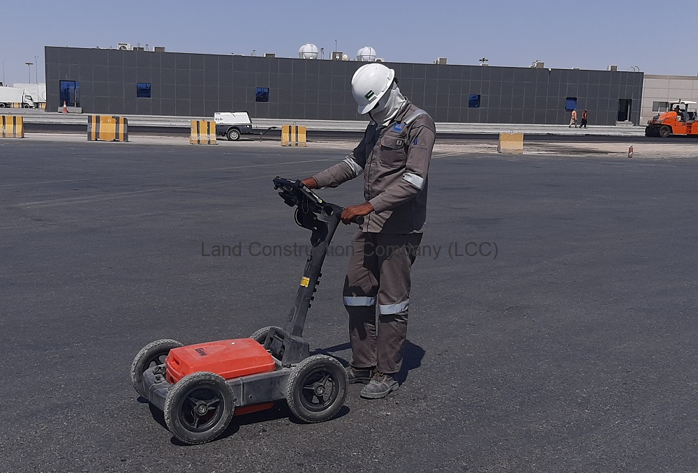
Underground Mapping, Ground Penetrating Radar (GPR Survey) is one of the most advanced underground utility locating techniques when combined with electromagnetic locating. 2D scans and 3D data acquisition are both available. GPR is used for the location and survey of conductive and non-conductive subsurface utilities and structures. It is the ideal way to locate.
⇒ Underground cavities detection and 3D Underground Scanning
⇒ Underground storage tanks and Underground structures
⇒ Underground sewer and stormwater lines detection
⇒ Concrete Structure and Slab Scanning
⇒ VC water mains and services detection
⇒ Voids and Cavity Detection
⇒ Fiber optic cables Detection
⇒ Forensics and Fuel tank detection
⇒ Road and pavement inspections
ABOUT THE LAND CONSTRUCTION COMPANY
Land Construction Company | KSA Land Surveyors was founded on the principle of giving our clients a top-quality product. Our full commitment is to excellence within our profession. We assure timely delivery, very competitive prices, and complete client satisfaction.
LCC is a company that is focused on delivering Civil Construction, Earthwork, Road Construction, Land Survey, Topographic, Quantity Survey, ArcGIS Services, GIS Remote Sensing, GIS Mapping, and Earthwork Quantity, cut and fill quantity, Underground Mapping, and Ground Penetrating Radar Services in the construction environment. LCC is Kingdom Saudi Arabia based company.
Underground Mapping GPR Survey
Company Profile
Underground Utility Survey and Mapping
Desktop Utility Records Search and Detection
Downtime can sometimes occur due to the late arrival of DURS. LCC’s specialized DURS team can reduce delays during the Underground Utility Detection process and
provide information quickly and efficiently to our clients.
Multiple Underground Utility Detection procedures can take place to provide the most accurate and detailed mapping. This includes GPR, Concrete Structure Scanner, and EML detection which are methods of non-invasive Underground Utility Detection.
Underground Mapping & Concrete Slab Scanning
Pipeline, Cable Locating and Cavity detection
This process also known as Electromagnetic Locating is used to identify the location of live conductive services and mains such as.
⇒ Water & Electricity (Underground Water Pipeline and Electric Cable Detection)
⇒ Gas and Fuel lines (Underground Gas Pipeline and Fuel Pipeline Detection)
⇒ Telecommunications (Underground Telecommunication Lines Detection)
⇒ Concrete Structures and Slab Scanning (Rebar, Conduit, Post-Tension Cables, Pan Decking, Voids, Metallic and Non-Metallic Service Utilities Survey Detection)
Underground utility mapping is a challenging task that shouldn’t be taken lightly. A project’s success is dependent upon the experience of the geophysical professional having a thorough understanding of the capabilities and limitations of their equipment within the given constraints of the site.
As a civil, earthwork, infrastructure, land survey, topographic survey, gis mapping, Geodetic Control Survey, Control Point, Benchmark Elevation, Underground Utility Mapping, Concrete Slab Scanning, Ground Penetrating Radar, and Underground cavity detection, Land Construction Co., adopts a disciplined and consistent approach to each and every time we take on projects… regardless of size or scale.
Our conservative approach ensures all projects tendered for are competitively priced with adequate resources assigned to ensure high-quality delivery in a timely manner.
Our vision is to be the company that others use as their benchmark. We will distinguish ourselves through our ability to consistently deliver on our commitments. Our standards will far exceed the expectations of our clients, but we will always strive for improvement. Our vision statement is to achieve a seamless system, from our first introduction to the final walkthrough. To achieve this, each member of our team must believe in and envelope our company’s culture.
Underground Mapping
Site Reconnaissance and Verification
Ground Penetrating Radar (GPR Survey)
Voids, Cavity Detection and Utility Survey
Underground Utility Detection survey
Before beginning an Underground Utility Detection survey, our team can walk the site and provide a Custom Street View. This allows us to visually identify any potential hazards from a surface level which we can feedback before further Underground Utility Detection takes place.
Verification
Underground Utility Detection begins with manhole reporting and verification of all manholes that could affect the specified area. This Underground Utility Detection method can be extended beyond the site boundaries if required.
We are a Land Construction Company and we provide our Underground Mapping GPR Survey services to the Kingdom of Saudi Arabia and the cities.
