Mining Survey
Land Construction Company
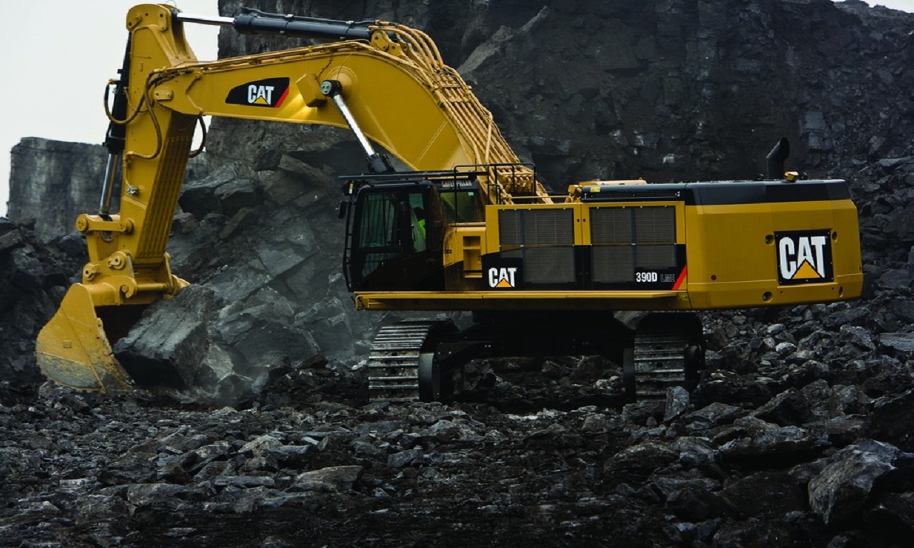
Land Construction Company has a comprehensive understanding and a wealth of experience when it comes to the various surveying requirements for mine quarries that operate throughout the Kingdom of Saudi Arabia. We offer mining survey services for underground and open-pit mine sites.
Mining Quarry and minerals are valuable resources that must be evaluated and managed properly. Our quarry surveyors help you to protect this asset by providing accurate data to aid in decision-making. With years of experience, we have long-term contracts with major quarry and landfill operators to provide volumetric surveys and update surveys on quarries and landfill sites.
Mining Survey
Surveying Services for Mining Quarries and Minerals
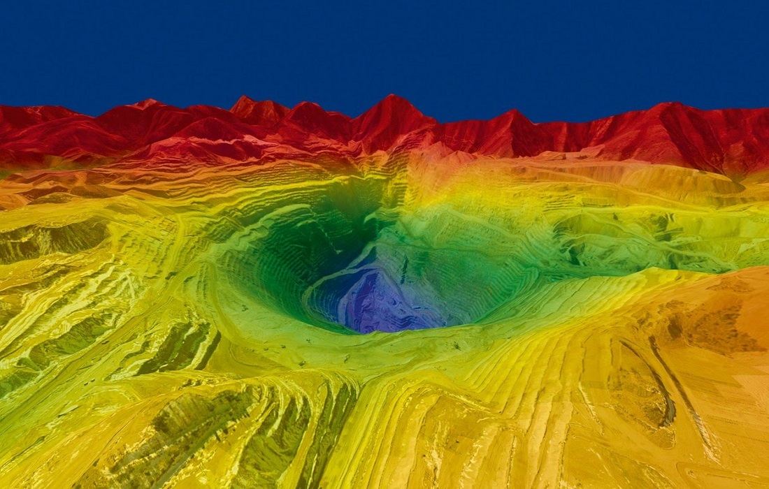
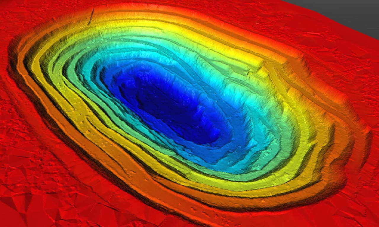
Land Construction Company provides mining survey services of product stockpiles, face updates using reflectorless instruments, and independent volume verification for earthworks, stockpiles, and mineral royalties. To improve time and cost-effectiveness we have utilized 3D Scanning, GPS Survey, and Aerial Survey Drone technology to produce ground terrain and topographic surveys of large sites. This method also can produce a rectified photogrammetric image of the site, which can be overlaid over the ground terrain model to produce a visually stunning model of the site.
Mining Survey
Our Services for the Mining and Mineral Industry Include
⇒ Volumetric Mining Survey of open cast mines, quarries, and stockpiles
⇒ Slope Monitoring/Detection
⇒ Rehabilitation Planning and monitoring Surveys
⇒ Exploration Surveys
⇒ Aerial Photography
⇒ 3D Laser Scanning
⇒ Weekly Progress surveys & reports
⇒ Contour and feature survey for mine design and planning
⇒ Plant, pit, and tailings dam set out and as-built surveys
⇒ Setting out of gridlines & Drill hole surveys
⇒ Mine site construction surveys
⇒ Mine site asbuilt surveys
⇒ Borehole & Test hole surveys
ABOUT THE LAND CONSTRUCTION COMPANY
Land Construction Company | KSA Land Surveyors was founded on the principle of giving our clients a top-quality product. Our full commitment is to excellence within our profession. We assure timely delivery, very competitive prices, and complete client satisfaction.
LCC is a company that is focused on delivering Civil Construction, Earthwork, Road Construction, Land Survey, Topographic, Quantity Survey, ArcGIS Services, GIS Remote Sensing, GIS Mapping, and Mining Survey Services. in the construction environment. LCC is Kingdom Saudi Arabia based company.
Company Profile
Mining Quarry or Mineral Survey
Mining Survey
Mine Quarry and Mineral Survey
What are mine quarry and mineral survey
A mine quarry survey is the mapping of a site that is specifically used for excavation or storage of mineral resources that have been mined.
What are mine quarry and mineral surveys used for
Our mining survey can be used for either mapping an entire quarry, profiling the rock faces, or doing blast analysis of the site before and after work has been done. The survey can be used for the calculation of mineral extraction quantities for royalties, to provide independent verification of earthworks volumes, and to ensure planning restrictions are being met.
Mining Survey
Volume Surveys
Volume surveys are performed, to determine the volume of material that has been excavated or fill quantities that have been placed on site. LCC Company can service small and large-scale earthworks projects and open-pit mining operations to determine the amount of material that has been mined. We can also survey stockpiles to determine volumes of material.
Autodesk Civil 3D, Microstation, Carlson survey & Microsurvey software is used to calculate the volumes and to provide comprehensive reporting and map output which gives our client excellent backup and confidence in our results. Our efficient techniques and coordination of our surveyors and equipment allow us to carry out the fieldwork and produce the final results within a short period of time which is an essential client requirement.
This information can be used for the payment of contractors or used as an audit reference against cruder methods of volume calculation such as dump truck counts.
As a civil, earthwork, infrastructure, land survey, topographic survey, gis mapping, mining survey, mining quarry or mineral survey, and 3d laser scanning, Land Construction Co., adopts a disciplined and consistent approach each and every time we take on projects… regardless of size or scale.
Our conservative approach ensures all projects tendered for are competitively priced with adequate resources assigned to ensure high-quality delivery in a timely manner.
Our vision is to be the company that others use as their benchmark. We will distinguish ourselves through our ability to consistently deliver on our commitments. Our standards will far exceed the expectations of our clients, but we will always strive for improvement. Our vision statement is to achieve a seamless system, from our first introduction to the final walkthrough. To achieve this, each member of our team must believe in and envelope our company’s culture.
Mining Survey
Benefits of a Mining Quarry or Mineral Survey
What are the benefits of a mining quarry or mineral survey
Commissioning a mining quarry survey will help accurate data, which can be used for valuation as well as aid in planning for the future of the quarry.
What can you expect from our survey
Land Construction Company can provide a 3D contoured terrain model of the quarry, production of volume calculations. When the survey has been carried out by 3D Scanning, GPS Survey, and Aerial Survey, a photo of the mining quarry upon which contours and features can be superimposed.
We are a Land Construction Company and we provide our services to, Jubail, Dammam, Khobar, Riyadh, Makkah, Madinah, Jeddah, Red Sea Project, Neom, Qiddiya, and other Kingdom Saudi Arabia cities.
