Land Construction Company
Our fast and accurate marine survey services assist in determining everything from the depth and bottom. Land Construction Company, provides Bathymetric Survey, Hydrographic survey, Dredging Survey, Meteorological, Oceanographic, Marine Geophysical Survey, Environmental baseline studies, or any specific survey and monitoring requirements survey services to engineers, aquatic construction companies, government agencies, and environmental professional clients. LCC hydrographic survey plans are delivered to requested scale design requirements and follow international Surveying and Mapping certification standards in the Kingdom of Saudi Arabia.
Bathymetric Survey and Marine Survey
Oceanographic Survey and Marine Survey
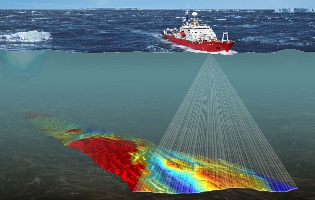
A bathymetric, or hydrographic survey, is an underwater topographical survey of a water’s bottom. It will measure the depth of water and reveal the amount of sediment that is present below the surface of the water. It’s an important part of the dredging process because it reveals the scope of the sediment problem in your seawater, lagoon, pond, Dam, lake, Marina, or stormwater basin. LCC uses Single Beam and Multibeam Echosounder, Marine Magnetometer, Sub Bottom Profiler, Side Scan Sonar, Tidal Gauge Monitoring, Acoustic Doppler Current Profiler (ADCP), and Conductivity, Temperature, and Depth (CTD), and GPS positioning technology to survey your body of water. The cost depends upon the size of the water body. If you decide to contract with us for your dredging project, we will then credit the cost of the survey to the price of the entire project.
Professional Hydrographic Survey
Hydrographic survey is the science of measurement and description of features that affect maritime navigation, marine construction, dredging survey, tides measurement, offshore oil exploration/drilling, and related activities. The term Hydrography is sometimes used synonymously to describe Maritime Cartography, which in the final stages of the hydrographic process uses the raw data collected through a hydrographic survey into information usable by the end-user.
Strong emphasis is placed on soundings, shorelines, tides measurement, currents, seafloor, and submerged obstructions that relate to the previously mentioned activities. Vessels equipped with Echo Sounding traditionally conduct hydrographic surveys.
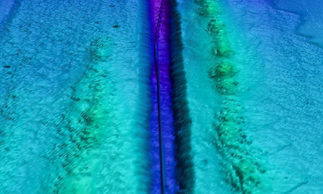
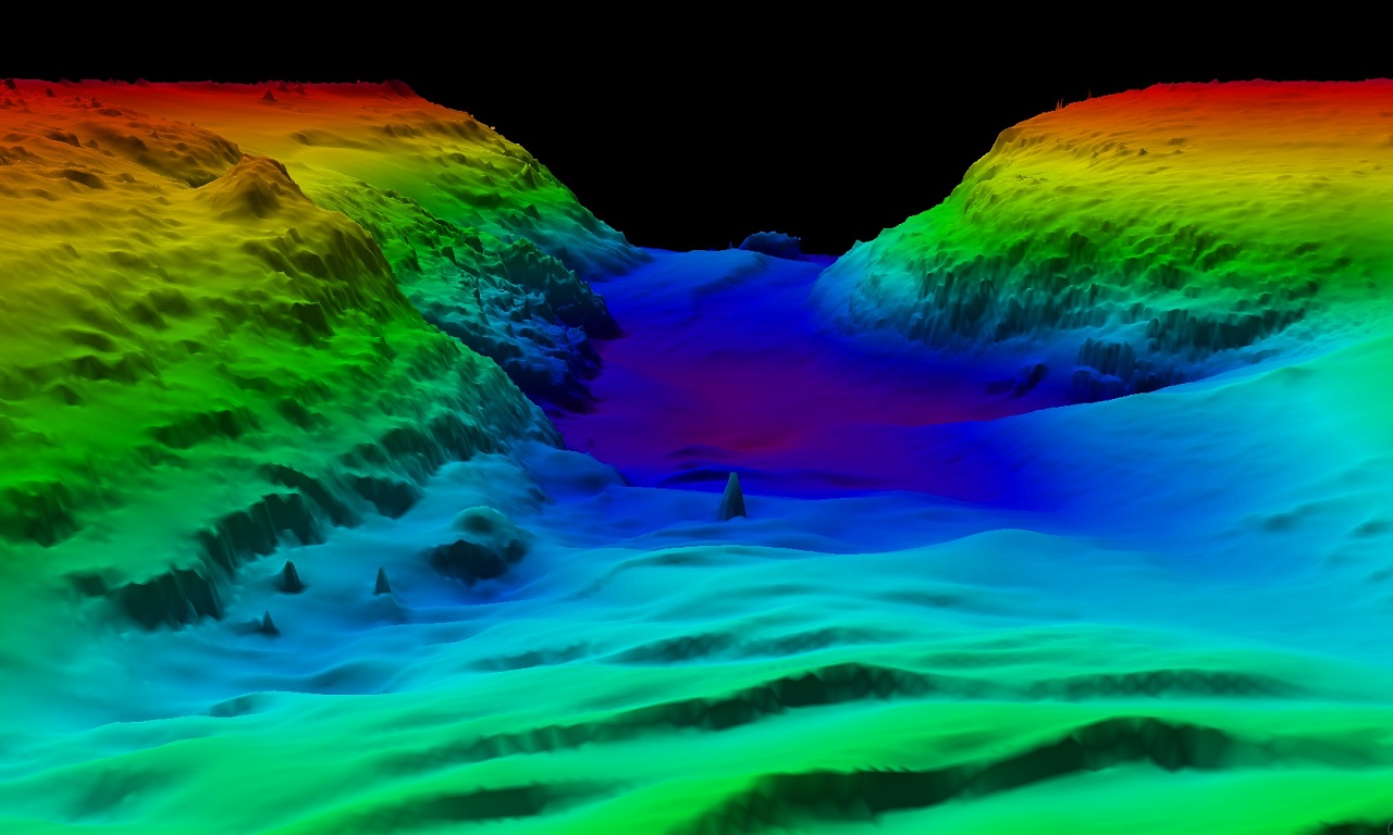
Latest Marine Survey and Mapping Projects
Multibeam, Sub Bottom Profiler, Side Scan, and Marine Magnetometer
⇒ Tidal Gauge Monitoring, near Khobar Coast Guard Jetty
⇒ Sub-Bottom Profiler, near SWCC Yanbu 3 power plant Project
⇒ Oceanographic ADCP & CTD Marine Survey, near SWCC Plant Al Tahliya Khobar
⇒ Multibeam Bathymetric Survey, Umm Al Hasani & Maktal Ali Islands Project in Neom
⇒ Multibeam Bathymetric Survey, at AL Birk Sand Beach
⇒ Multibeam Bathymetric Survey, Side Scan Sonar, Marine Magnetometer, and Tidal Gauge Monitoring Survey, at Umluj Cable System Project in Umluj Red Sea.
⇒ Sub-Bottom Profiler and Marine Magnetometer Survey at Jazan Port
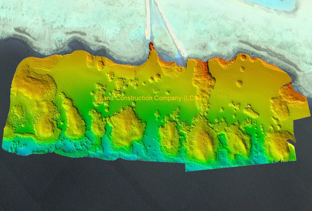
Bathymetric Survey and Marine Survey
Norbit Single Beam and Multibeam Bathymetric Surveying
LCC survey team performs single beam and multibeam bathymetric surveys with a specific focus on delivering high-quality data that affords maximum suitability for a variety of design and visualization applications. We survey ports, harbors, rivers, lakes, and reservoirs inshore, as well as in the open ocean offshore. Working in accordance with the International Hydrographic Organization, we aim to meet or exceed the standards of accuracy, resolution, survey coverage, and delivery requirements set for every project.
As opposed to traditional single-beam bathymetric survey techniques that produce soundings on discrete profiles, multibeam bathymetry affords the end-user with a highly detailed, densely spaced grid of soundings in the form of a geographically referenced digital terrain model. This model can support engineering design, construction, and dredging projects. The key advantages to multibeam bathymetry, as opposed to single-beam bathymetry, are increased data coverage, greater data density, and greater survey production capacity.
ABOUT THE LAND CONSTRUCTION COMPANY
Land Construction Company | KSA Land Surveyors was founded on the principle of giving our clients top-quality products. Our full commitment is to excellence within our profession. We assure timely delivery, very competitive prices, and complete client satisfaction.
LCC is a company that is focused on delivering Marine Survey, Civil Construction, Earthwork, Road Construction, Land Survey, Topographic, Quantity Survey, ArcGIS Services, bathymetric survey and hydrographic survey, GIS Remote Sensing, GIS Mapping, and Geodetic Control Survey and Aerial Survey and Mapping Services. in the construction environment. LCC is Kingdom Saudi Arabia based company.
Bathymetric and Hydrographic Survey
Company Profile
Hydrographic Survey
Marine and Hydrographic and Bathymetric Survey Capabilities
LCC Marine Survey Services, hydrographic surveying capabilities include geodetic control surveys, tidal observations and datum computations, shoreline validation, current velocity measurements, and high-resolution Norbit multibeam sonar, Norbit single beam sonar, and side-scan sonar surveying services. We use GPS and total station equipment to survey embankments, smaller waterways, and structures such as bridges, walls, and weirs. Survey information is processed through dedicated mapping software to produce a range of hydrographic survey deliverables.
Bathymetric Survey
Multibeam Bathymetric Survey Types
⇒ Bathymetric survey and mapping, and geophysical surveys.
⇒ Initial and in-progress surveys for bridge, and aquatic infrastructure projects.
⇒ Volume surveys for storm and industrial ponds/sites.
⇒ Ports, Harbors, and Jetty Construction Survey.
⇒ Dredging Survey and volume reporting.
⇒ Scour investigations / positioning / imaging.
⇒ Pond liner integrity surveys.
⇒ Utility depth of cover surveys.
⇒ In-stream construction as built.
⇒ Target search and positioning surveys.
⇒ Sedimentation accumulation surveys.
⇒ Visual assessments (stationary habitat cameras, side scan sonar).
As a civil, earthwork, infrastructure, land survey, topographic survey, gis mapping, Geodetic Control Survey, Control Point, Benchmark Elevation, bathymetric survey and hydrographic survey, tides measurement, Sub-bottom Profiler Survey, Shallow Seismic Survey and 3d laser scanning, Land Construction Co., adopt a disciplined and consistent approach each and every time we take on projects… regardless of size or scale.
Our conservative approach ensures all projects tendered for are competitively priced with adequate resources assigned to ensure high-quality delivery in a timely manner.
Our vision is to be the company that others use as their benchmark. We will distinguish ourselves through our ability to consistently deliver on our commitments. Our standards will far exceed the expectations of our clients, but we will always strive for improvement. Our vision statement is to achieve a seamless system, from our first introduction to the final walkthrough. To achieve this, each member of our team must believe in and envelope our company’s culture.
We provide our marine survey, bathymetric survey, and hydrographic survey services to, Rabigh, Jubail, Dammam, Khobar, Ras Tanura, Jeddah, Yanbu, Dhiba, Ras Al Khair, Jizan, Red Sea Project, Neom, Saudi Sea Ports, and all Kingdom Saudi Arabia cities and also we can provide survey services in Dubai, UAE, Bahrain, Qatar, and Oman.
Hydrographic Survey & Dredger Sea Survey
Ports, Harbours, Coastal and Jetty Construction Survey
Oceanographic and Marine Survey
Sea Tides Measurement and Observation
⇒ Norbit Single Beam and Norbit Multibeam Bathymetric survey.
⇒ Underwater Pipeline surveys / Seabed Sediment Sampling and Testing.
⇒ Sea Bed Imaging using Side scan sonar survey.
⇒ Hydrodynamic study and Tidal measurements.
⇒ Below Sea, Bed Profiling to Determine Subsurface Geology.
⇒ Sub-bottom Profiler Survey / Shallow Seismic Survey.
⇒ Supervision and control of dredge operations.
⇒ Marine recirculation studies and Wreck investigations.
⇒ Sand thickness measurements underwater / Water Sampling and Testing.
⇒ Dive inspections and underwater photography / Magnetic Survey and ROV Survey.
⇒ Current & Wave Measurements using an Acoustic Doppler Current Profiler (ADCP).
⇒ Marine geophysical survey and Marine environmental study.
We are a Land Construction Company and we provide our bathymetric survey and hydrographic survey services to, the whole Kingdom of Saudi Arabia and Sea Ports.
